Know how far your place is from the West Valley Fault w/ Project Tremors

With the upcoming second Metro Manila Shake Drill, we found this website useful for those who are still not familiar with the West Valley Fault that transverses from Bulacan to Laguna in the island of Luzon.

project-tremors

Project Tremors gives users the ability to exactly know the distance of their location from the West Valley Fault. Simply input your place in the search box and the site will give your distance from the fault line.

You can also check out where the 100km earthquake-prone line runs through Metro Manila and its neighboring cities and districts. And, know the nearest hospitals and designated evacuation centers. To check it out, head over to the source link below.

The site is the brainchild of web developers namely Dominic Tuazon, Louis Michael Concepcion, Mic Gutierrez, Kyle Abughanem, and Emmanuel Soriano with sources from certain government departments and news agencies.

Source

The post Know how far your place is from the West Valley Fault w/ Project Tremors appeared first on YugaTech | Philippines News & Tech Reviews.

MMDA launches Metro Manila earthquake preparedness website

The recent series of earthquakes has made the media and government more concerned about the potential disaster that could happen in Metro Manila. A series of disaster preparedness programs headed by the Metro Manila Development Authority in cooperation with LGUs, Dep Ed, DPWH and PhiVolcs has been running in full scale since last month.

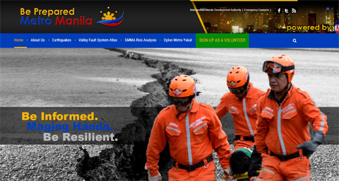
The MMDA has recently launched the Be Prepared Metro Manila website to provide crucial information about earthquake preparedness with special focus on the West Valley Fault that cuts across multiple cities in Metro Manila.

The website outlines vast information about earthquakes, GMMA Risk Analysis, OPLAN Metro Yakal and the Valley Fault System Atlas.

The Valley Fault System (VSF) Atlas is a handbook of large scale maps showing in detail areas traversed by the Valley Faul System. It was developed and launched by the Philippine Institute of Volcanology and Seismology (PHIVOLCS) and the Department of Science and Technology (DOST). The VFS is an active fault system in the Greater Metro Manila Area (GMMA) composed of two fault traces: the 10 km long East Valley Fault in Rizal and the 100 km long West Valley Faultruns through different cities and towns of Bulacan, Rizal, Metro Manila, Cavite and Laguna.

Check out the dedicated website Be Prepared Metro Manila by the MMDA here.

The post MMDA launches Metro Manila earthquake preparedness website appeared first on YugaTech | Philippines, Tech News & Reviews.